When I left off last time I was ready to double down on a map that I definitely was not happy with. Attempting to find some resources on texturing a map I came across a post about using Google Earth imagery. Now, this was really interesting, but it just felt like it would be a huge waste given the state of my maps right now. So, back to Wilbur I go.
One thing ma definitely needs right now is islands. I was looking at some island arcs (which ended up dragging me into a huge tangent), and I think I need to focus on building out from a volcano point with eroded land. To that end I painted in some islands, raised the land, eroded, lowered back down, a whole bunch. I also upscaled the image so now it’s way too big (~20MB for the texture). Obviously I still have to share it here, so I popped it open in Photoshop and just compressed it down a bit for your viewing pleasure:
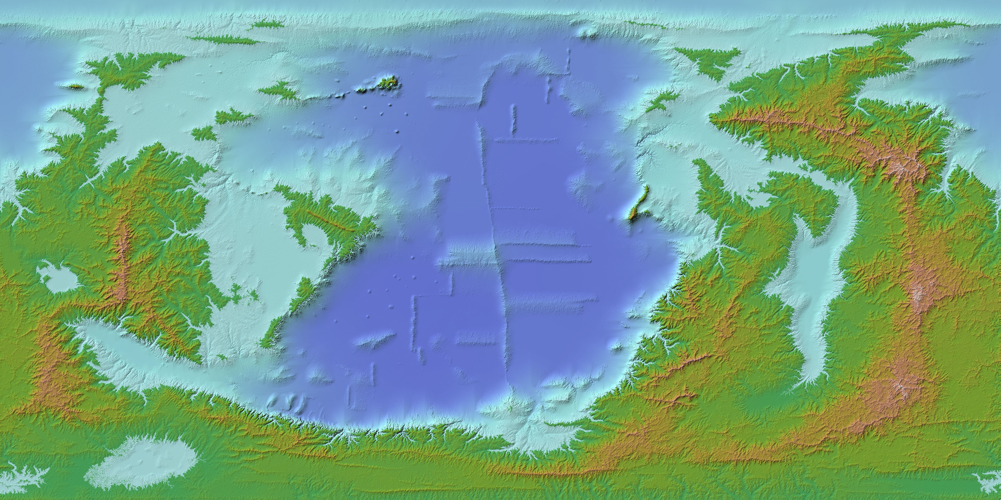
FIGURE 8. Larger map with more islands.
Ok. Fuck this. I’m not happy with it at all. Fresh start, I need something that feels better from the ground up. There needs to be volcanoes and glaciers and maybe even some asteroids. I’m going for a world here not a field of rivers. To do this I’ll need a new map generator. First one I come across is Experilous: Map Generator, which is really nice, it has tectonics and climate but it doesn’t seem to output a usable heightmap. Here is the output I get from it:
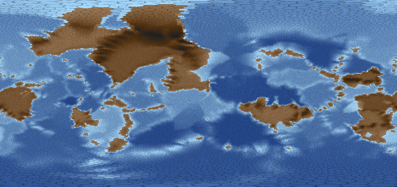
FIGURE 9. Map generated using experilous.com/….
Further searching, I found Tectonics.js by davidson16807, which has a greater capability when it comes to heightmaps but still lacks in detail (esp. with regards to the ocean floor). Here’s what its output looks like:
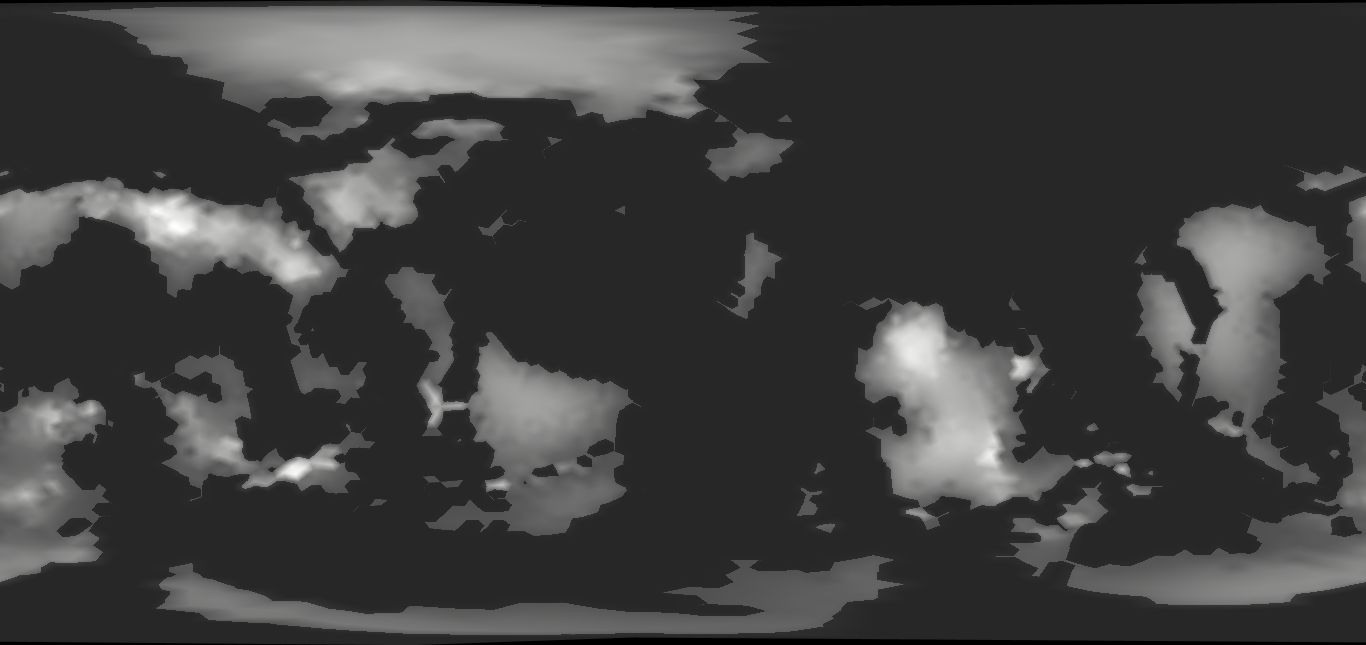
FIGURE 10. Map generated using Tectonics.js.
Back to searching, I saw someone recommend a program called “Platec” but I can’t find a download for Windows. To that end, I found a fork of it creatively called plate-tectonics. The issue with this one is that it’s in 2D, so it wraps on the $y$-axis 😟. I’ll move forward with it, but understand I have little confidence. It’s implemented into a larger program by the same author, Mindwerks: worldengine, so I’ll run it through that.
This takes quite a bit to simulate all the tectonics and erosion so while I wait for that I ran Fig.10 through Wilbur a bit, which created this fairly interesting concoction:
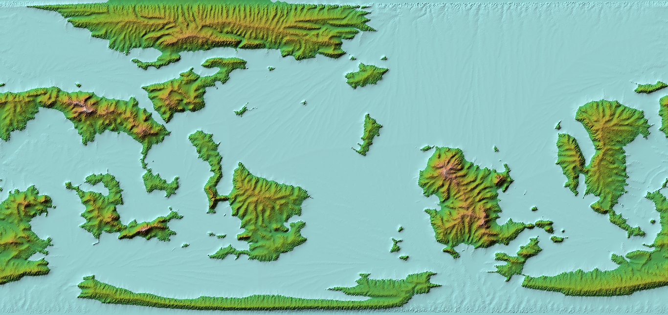
FIGURE 11. Figure 10 eroded with Wilbur.
This isn’t that bad to be honest, it’s still just missing a lot of ocean details that kind of make the tectonics simulation route worthwhile. I, of course, forgot that the worldengine default is $512\times512$ so I had to redo it using the command
worldengine world -gs -q 50 -x 2048 -y 1024
For the list of options here read the docs. Larger files mean ever larger waiting times, so I’m just sitting here watching Neo Yokio again. So, I tried to get a grayscale heightmap, but evidently that didn’t work. Regardless of that, here’s a biome map that it produced which I think looks neat:
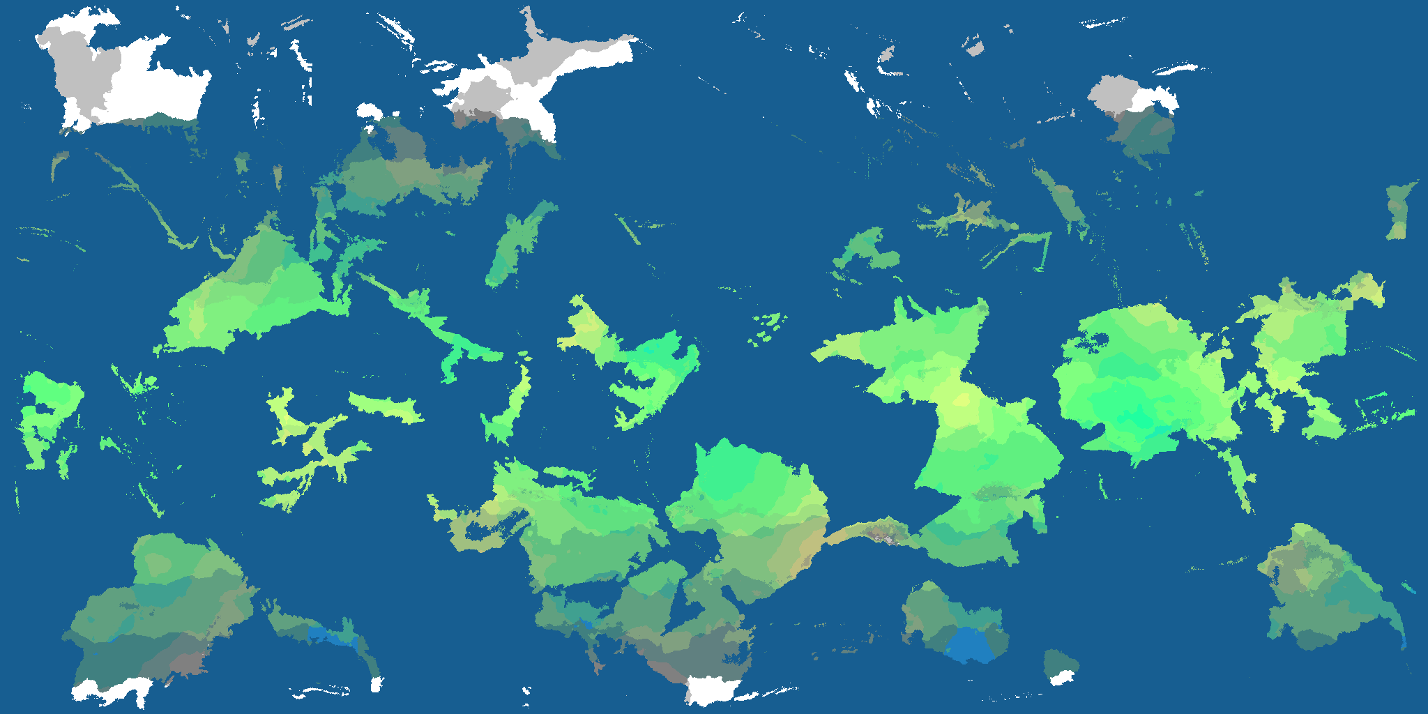
FIGURE 12. Biome map produced by worldengine.
It looks a bit too island-y for my taste, but it’s better to have islands and not need them than to not have islands an need them. Next step is, once again to pass this through Wilbur and see what we can do.
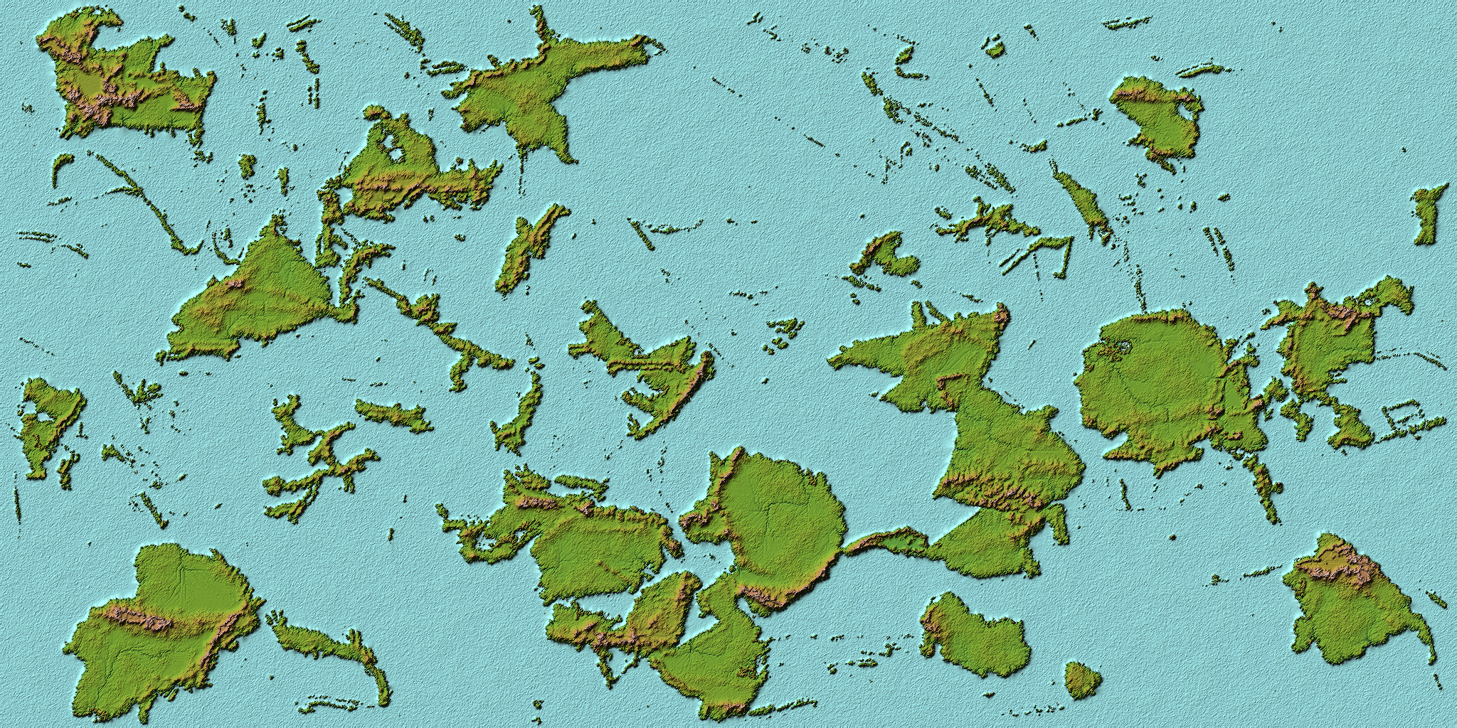
FIGURE 13. Worldengine map after some quick adjustments in Wilbur.
This needs a lot of work on the oceans still, but I forgot to output this plates so I’m going to try to generate them using the command
worldengine plates -gs -q 50 -x 2048 -y 1024 -s 56756
and praying to the RNG gods that this will result in the same end state. After waiting for who knows how long, I was blessed with this beautiful image:
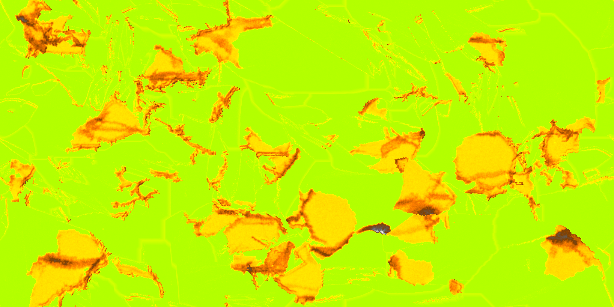
FIGURE 14. Map of tectonic plates generated by worldengine.
Using this as a guideline, I went through and used the paintbrush with the maximum filter set to some arbitrary value and drew in my continental shelves. Gave this the typical treatment: raise above sea level, add noise, fill basins, precipiton-based erosion, incise flow, lower back down, etc. Running through that in cycles, mixing it up and whatnot, eventually ending up with this:
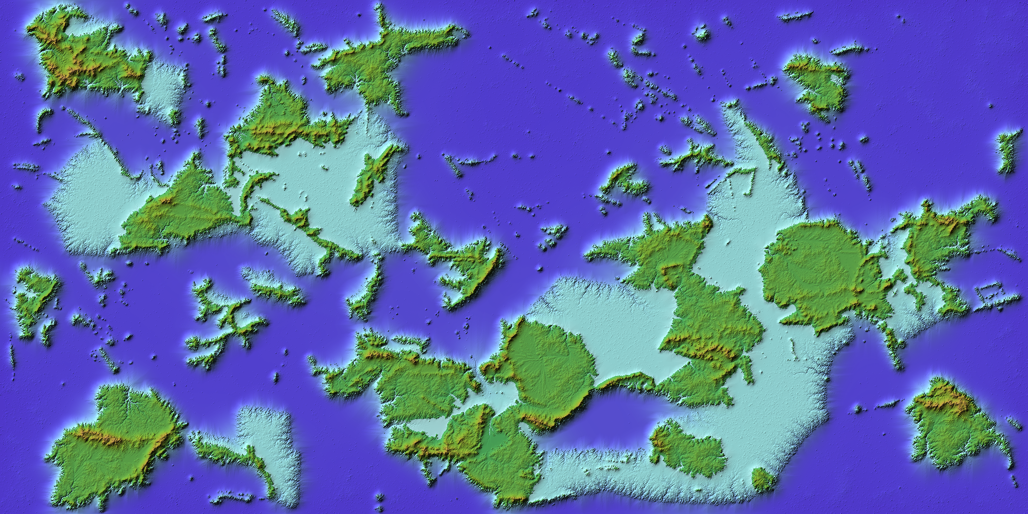
FIGURE 15. Manually added continental shelves in Wilbur.